MAPPING SOLUTIONS

Transform Location Data Into Actionable Intelligence

Spatial Insights helps organizations visualize incidents, resources, and geographic trends through advanced mapping and analytics. Turn complex location data into operational intelligence that supports faster decisions, improved coordination, and greater situational awareness.

SPATIAL INTELLIGENCE

See More. Know More. Respond Smarter.

Spatial Insights combines GIS technology, operational data, and advanced analytics to provide greater visibility into incidents, resources, and emerging trends.

Real-Time Situational Awareness

Visualize incidents, assets, and operational activity on interactive maps that provide immediate context for decision-making.

Geographic analysis
Advanced Geographic Analytics

Identify patterns, trends, and potential risks through location-based intelligence designed to support planning and operational readiness.

Monitor personnel
Enhanced Resource Visibility

Monitor personnel, assets, and response resources across geographic areas to improve coordination and deployment decisions.
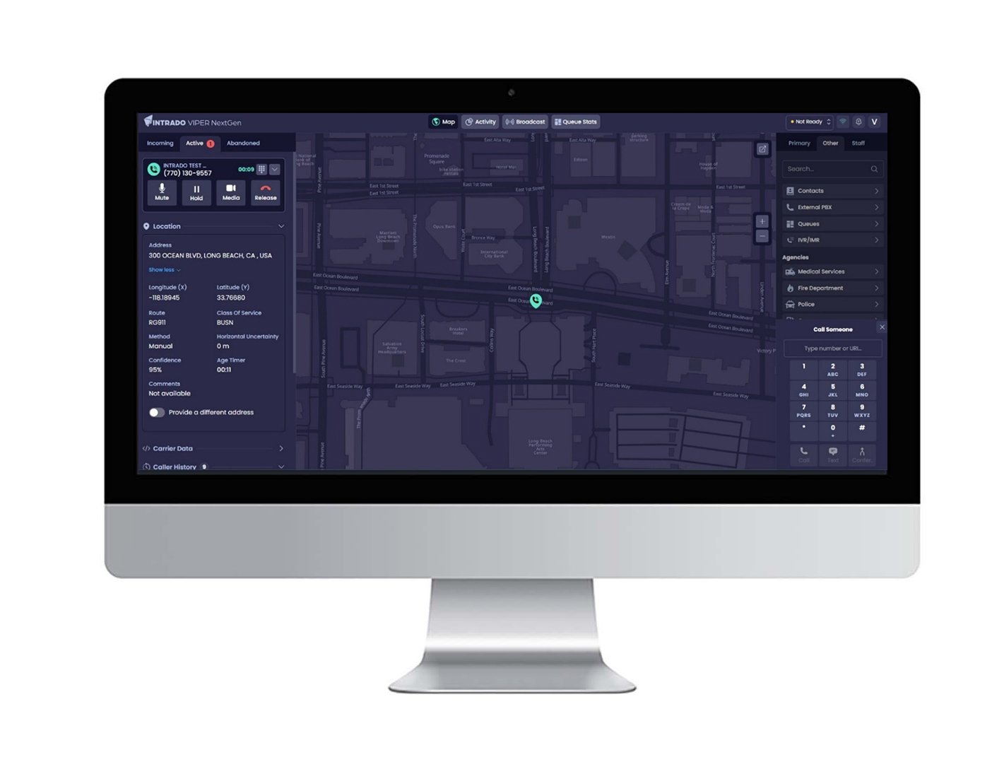
 

Spatial Insight Product Screen

GIS INTELLIGENCE

Turn Mapping Data Into Operational Insight

Spatial Insights combines geographic information systems (GIS) technology with operational data to create a comprehensive view of incidents, resources, and activity. By connecting information to location, organizations can better understand conditions, identify trends, and support more informed decision-making.

PREDICTIVE ANALYSIS

Identify Trends Before They Become Challenges

Advanced analytics capabilities help organizations uncover patterns, evaluate historical activity, and anticipate potential operational impacts. Spatial Insights provides the intelligence needed to improve planning, resource allocation, and preparedness efforts.

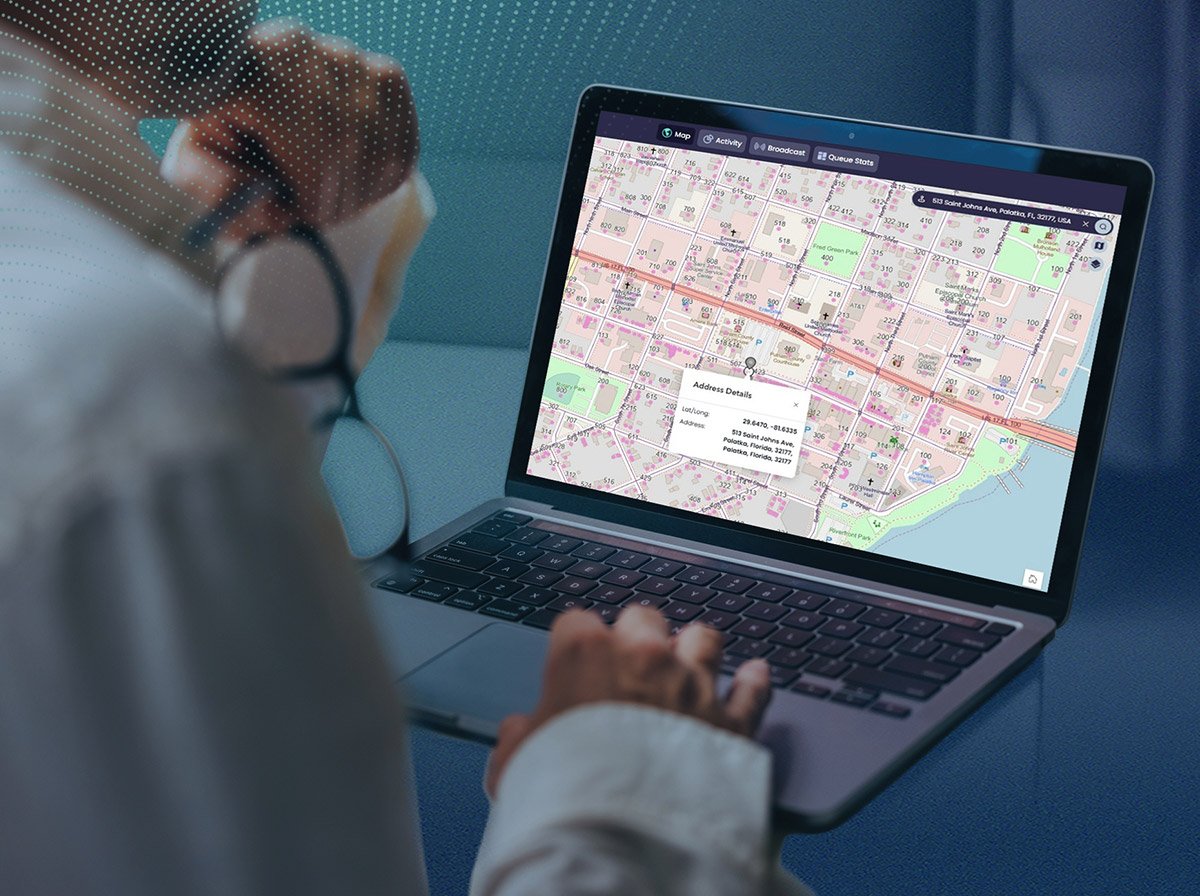
Spatial Insights Screen
45

years of industry innovation leadership

1000
+

NG9-1-1 networks displayed

410
M+

9-1-1 transactions annually

4.7
M+

text-to-9-1-1 messages recieved

EXPLORE RELATED SOLUTIONS

Expand Your Geographic Intelligence Capabilities

Spatial Insights works alongside Intrado's mapping, analytics, and emergency communications technologies to provide greater visibility, stronger coordination, and more informed decision-making across critical operations.

Intrado_LightningIcon

GIS

Leverage geographic information systems technology to visualize incidents, assets, and operational activity through location-based intelligence.

Intrado_LightningIcon

Spatial Command & Control

Improve situational awareness and incident coordination through real-time operational visibility and resource management.

Intrado_LightningIcon

ECaTS

Transform emergency communications data into actionable insights through advanced analytics and reporting capabilities.

Intrado_LightningIcon

NG9-1-1 Core Services

Support modern emergency communications environments with scalable, reliable NG9-1-1 infrastructure.

Intrado_LightningIcon

Professional Services

Maximize the value of mapping and intelligence technologies through implementation support, optimization, and expert guidance.

Intrado_LightningIcon

Cybersecurity

Protect critical communications and operational systems with security-focused technologies and expertise.

Frequently Asked Questions

Download the 2026 State of the 9-1-1 Industry Report 

Latest News

688838e7-3120-418c-b217-8e1e5ac0de51

PSAP SOLUTIONS

Smarter call handling and faster emergency response.

Our powerful call handling and management systems are backed by a deep understanding of emergency response protocol.

688838e7-3120-418c-b217-8e1e5ac0de51

NIS SOLUTIONS

Secure, reliable networks for critical communications.

Call routing, location and data solutions connect subscribers to emergency services and keeps OSPs compliant.

688838e7-3120-418c-b217-8e1e5ac0de51

ENTERPRISE SOLUTIONS

Protect people & operators with trusted alerts

Keep employees safe regardless of where they work while complying with state and federal regulations.