
Oct 19, 2026
When an emergency unfolds, every second matters. The ability to quickly identify what's happening,
Oct 19, 2026
By: Intrado
Nextiva Selects Intrado NG Nexus™ to Advance NG9-1-1 Compliance Readiness Longmont, Colo., Oct. 19,
Oct 19, 2026
By: Brooke McGowan
When the FCC 24-78 clock starts, there’s very little time to figure it out as you go. For any
Oct 14, 2026
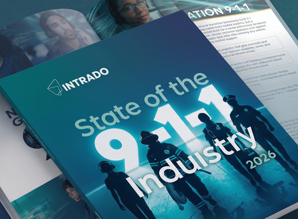
Part of Intrado's "Inside the 2026 State of the 9-1-1 Industry Report" webinar series, this session
Oct 12, 2026
By: Intrado
Longmont, Colo., October 12, 2026 — Intrado Life & Safety, Inc. (Intrado), a global leader in
Oct 8, 2026
By: Brooke McGowan
Here's a grim stat: every year, more than 40,000 people die in car accidents in the US, and
Oct 7, 2026
Intrado helps hotels and resorts coordinate a faster, more effective emergency response from the
Oct 6, 2026
By: Intrado
Marcando el rumbo en tendencias y tecnologías El Informe sobre el Estado de la Industria del 911 en
Sep 29, 2026
By: Nina Hymel
The journey from crash to care depends on seamless communication, accurate information, and rapid
Sep 17, 2026
By: Intrado
Watch the recorded webinar to gain the latest insights into the NG9-1-1 transition landscape,
Sep 10, 2026
A year and a half into FCC 24-78, and with 2565 PSAPs requesting Phase 1 service (as of September
Sep 10, 2026
Every September, FEMA's National Preparedness Month serves as an important reminder that
Sep 9, 2026
By: Brooke McGowan
Watch the recorded webinar where we cover the 2026 State of the 9-1-1 Industry Report: AI.
Sep 9, 2026
By: Intrado
LONGMONT, Colo., Sept. 09, 2026 –Intrado Life & Safety, Inc. (Intrado), a global leader in
Sep 8, 2026
By: Brooke McGowan
Every year, communities across the country pause to recognize National 988 Day of Awareness, a date
Sep 4, 2026
Intrado OneAlert™, Now Available in French, Extends Emergency Readiness for Multilingual Enterprises
By: Intrado
LONGMONT, Colo., August 26, 2026 –Intrado Life & Safety, Inc. (Intrado), a global leader in
Sep 2, 2026
By: Intrado
Longmont, CO and Reston, VA – September 2, 2026 – Intrado Life & Safety, Inc. (Intrado), a leader
Sep 2, 2026
By: Brooke McGowan
In a recent Intrado webinar, public safety experts and some of the authors of Intrado's 2026 State
Aug 27, 2026
By: Brooke McGowan
Every second matters after a serious collision, but today, getting help moving fast still depends
Aug 17, 2026
Watch our recorded webinar with Algo about how K-12 and higher education institutions can
Aug 17, 2026
By: Intrado
Intrado Emergency Routing Service (ERS) is now available for Cisco Webex Calling Multi-Tenant
Aug 13, 2026
By: Nina Hymel
August is National Wellness Month, a time dedicated to promoting healthy habits and prioritizing
Aug 10, 2026
As public safety agencies continue to modernize emergency communications infrastructure, Next
Aug 5, 2026
By: Intrado
Watch our recorded Share.Solve.Evolve. webinar led by D. Jeremy DeMar, Intrado's Senior Government
Aug 5, 2026
Effective emergency communication depends on delivering the right message to the right people at
Jul 28, 2026
By: Intrado
Longmont, CO – July 28, 2026 – Intrado Life & Safety, Inc. (Intrado), a global leader in emergency
Jul 21, 2026
By: Intrado
How prepared is your organization if an emergency were to occur? In a critical situation, every
Jul 21, 2026
By: Intrado
Meet Intrado OneAlert™, our next-generation mass notification platform designed to streamline and
Jul 21, 2026
By: Intrado
Protect your people, facilities, and critical assets with Intrado OneAlert™ — a comprehensive
Jul 20, 2026
By: Intrado
LONGMONT, Colo., July 20, 2026 — Intrado,a global leader in emergency communications technology,
Jul 17, 2026
By: Brooke McGowan
This summer, millions of fans bounced between the US, Canada, and Mexico for the World Cup. Good
Jul 7, 2026
On-Demand Share.Solve.Evolve. Webinar: Introducing Intrado's 2026 State of the 9-1-1 Industry Report
Watch our recorded Share.Solve.Evolve. webinar introducing Intrado's 2026 State of the 9-1-1
Jun 30, 2026
Watch ourrecordedShare.Solve.Evolve. webinar led by D. Jeremy DeMar, Intrado's Senior Government &
Jun 26, 2026
By: Admin
Explore our interactive Emergency Routing Services (ERS) demo to see how Intrado's ERS ensures
Jun 26, 2026
By: Admin
Explore our interactive Intrado OneAlert™ demo to see our comprehensive emergency notification and
Jun 24, 2026
By: Intrado
LONGMONT, Colo., June 24, 2026 — Intrado,a global leader in emergency communications technology,
Jun 23, 2026
By: Intrado
LONGMONT, Colo., June 23, 2026 — Intrado, a global leader in emergency communications technology,
Jun 23, 2026
By: Intrado
The Decisions Shaping The Future of 9-1-1 Are Being Made Now. The 2026 State of the 9-1-1 Industry
Jun 18, 2026
By: Admin
Explore our interactive VIPER NextGen demo to see how a unified, intelligent platform helps
Jun 17, 2026
By: Intrado
LONGMONT, Colo., June 17, 2026 — Intrado, a global leader in emergency communications technology,
Jun 16, 2026
By: Intrado
LONGMONT, Colo., June 16, 2026 — Intrado is proud to announce that it has been named a winner of
Jun 5, 2026
There's a pattern emerging among smaller ILECs and rural carriers grappling with FCC 24-78 and the
May 27, 2026
By: Intrado
LONGMONT, Colo., May 27, 2026 — Intrado Life & Safety, Inc. (Intrado), a global leader in emergency
May 26, 2026
During an emergency, getting help to the right place and the right people inside your organization
May 8, 2026
Public Safety Answering Points (PSAPs) and emergency communications centers across North America
May 6, 2026
By: Intrado
When emergencies happen, dialing 9‑1‑1 is only part of the response. Today’s enterprises need
May 5, 2026
Safety is a shared responsibility across organizations whether you operate an enterprise campus,
Apr 27, 2026
By: Brooke McGowan
Response on the Road When a serious collision happens, everything comes down to timing. Emergency
Apr 24, 2026
By: Brooke McGowan
Twelve months feels like a long time until you’re in the middle of it. For non-nationwide carriers
Apr 22, 2026
Watch our recorded Share.Solve.Evolve. webinar led by D. Jeremy DeMar, Intrado's Senior Government
Apr 20, 2026
By: Intrado
Problem Many PSAPs and ECCS still rely on fragmented, legacy systems for location and incident
Apr 17, 2026
By: Nina Hymel
Modern emergency call handling relies on accurate, timely location data — yet too often, that data
Apr 14, 2026
Emergency Communication Centers (ECCs), or Public Safety Answering Points (PSAPs), serve as the
Apr 10, 2026
March 25, 2026, marked the first anniversary of the FCC's announcement that 9-1-1 Authorities could
Apr 10, 2026
By: Nina Hymel
In moments of crisis, before emergency vehicles arrive or flashing lights appear, one connection
Apr 8, 2026
LONGMONT, Colo.,April 08, 2026 — Intrado Life & Safety, Inc. (Intrado), a global leader in
Apr 7, 2026
Every year, emergency call centers in the United States handle an estimated 240 million 9-1-1
Apr 1, 2026
Watch our Share.Solve.Evolve. webinar led by D. Jeremy DeMar, Intrado's Senior Government &
Mar 27, 2026
We’re excited to share some outstanding news. Intrado OneAlert™ has been named a winner of the Best
Mar 24, 2026
In an era where smartphones can pinpoint a coffee shop within meters, it is easy to assume that
Mar 16, 2026
When the FCC adopted Order 24-78, it gave non-nationwide originating service providers (OSPs) a
Mar 16, 2026
By: Admin
Readying Low Earth Orbit Satellite Services for Emergency Communications The much-talked-about
Mar 6, 2026
Driving the Conversation on Trends and Technologies What did the 2025 State of the 9-1-1 Industry
Mar 6, 2026
By: Intrado
The transition to NG9‑1‑1 is well underway — but for many Originating Service Providers (OSPs), the
Mar 5, 2026
Recently, we published a whitepaper that deep dives into how Advanced Automatic Collision
Mar 3, 2026
On-Demand Share.Solve.Evolve. Webinar: Drive for 2000 Lives With AACN and 9‑1‑1 Innovation | Part 1
Watch our recorded Share.Solve.Evolve. webinar led by D. Jeremy DeMar, Intrado's Senior Government
Mar 3, 2026
By: Ravish Malhotra
In today’s rapidly evolving technological landscape, emergency communications centers (ECCs) — also
Feb 27, 2026
What if smarter vehicle data could save over 2000 lives a year? In this episode ofUnder the Hood:
Feb 17, 2026
By: Intrado
Problem Many PSAPs and ECCS still rely on legacy technology such as Centralized Automatic Messaging
Feb 13, 2026
Emergency Communication Centers (ECCs), also known as Public Safety Answering Points (PSAPs), are
Feb 6, 2026
In healthcare, a delay of even a few seconds can change a patient’s outcome. Hospitals, clinics,
Jan 29, 2026
Watch our recorded Share.Solve.Evolve. webinar led by D. Jeremy DeMar, Intrado's Senior Government
Jan 23, 2026
We’re thrilled to announce that Intrado has been honored with the 2026 BIG Innovation Award for
Jan 21, 2026
We Are Intrado — Empowering 9‑1‑1 Professionals Every call for help deserves a response powered by
Jan 7, 2026
By: Intrado
It’s been more than five years since the Federal Communications Commission (FCC) adopted rules to
Jan 7, 2026
At CES 2026, Intrado and SBD Automotive showcased a breakthrough in vehicle safety with Advanced
Jan 6, 2026
LAS VEGAS, NV, LONGMONT, CO, MILTON KEYNES, UK. — January 6, 2026 — At CES 2026, Intrado Life &
Jan 6, 2026
By: Intrado
Every second matters after a serious crash. Traditional emergency response relies on a witness,
Dec 12, 2025
Watch our recorded Share.Solve.Evolve. webinar led by D. Jeremy DeMar, Intrado's Senior Government
Dec 10, 2025
By: Rylie Baldes
Since 1988, Intrado has been committed to supporting its employees through life's toughest moments.
Dec 4, 2025
When most people think about calling 9-1-1, they picture a simple, direct connection between their
Dec 4, 2025
The DIY home alarm solution market is booming, with over half of households in the U.S already
Dec 3, 2025
By: Rylie Baldes
In emergencies, every second counts - and every life matters. But what happens when someone can't
Nov 21, 2025
By: Rylie Baldes
Discover What's Shaping the Future of Emergency Communications Intrado's 2025 APCO/NENA Survey
Nov 20, 2025
When you call 9-1-1, the last thing you want is for your call to be routed to the wrong dispatch
Nov 19, 2025
Emergencies demand speed, clarity, and coordination whether in education, healthcare, enterprise,
Nov 7, 2025
By: Intrado
Intrado OneAlertTM Unified Mass Notification Platform for On-Premises Emergency Alerts, IP Paging &
Oct 31, 2025
In June 2022, New York Governor Kathy Hochul signed Alyssa’s Law. This law requires schools to
Oct 31, 2025
By: Intrado
Intrado OneAlertTM Unified Mass Notification Platform for On-Premises Emergency Alerts, IP Paging &
Oct 31, 2025
Intrado provides innovative and life-saving solutions that can help schools easily communicate with
Oct 16, 2025
Phase 2 of the FCC’s NG9-1-1 transition order has arrived, revolutionizing call routing, location
Oct 15, 2025
My son, who works providing camp equipment and services to firefighters in remote areas, recently
Oct 14, 2025
Every day, across the nation, first responders step up to the plate. Firefighters, law enforcement
Oct 9, 2025
By: Intrado
Recent FCC Guidance Increases the Imperative for Organizations to Ensure Kari's Law and RAY BAUM'S
Oct 6, 2025
Watch this recorded Share.Solve.Evolve. webinar led by D. Jeremy DeMar, Intrado's Senior Government
Oct 2, 2025
By: Intrado
Marcando el rumbo en tendencias y tecnologías El Informe sobre el Estado de la Industria del 911 en
Sep 30, 2025
At Intrado, we believe that the strength of our cybersecurity program lies not just in our
Sep 26, 2025
Not every career begins where you think it will. For Mariana Salazar, her journey into the world of
Sep 17, 2025
LONGMONT, CO – September 17, 2025 –Intrado Life & Safety, Inc. (Intrado), the leader in emergency
Sep 15, 2025
September is FEMA's National Preparedness Month, a time to reflect on how we can better prepare for
Sep 12, 2025
Being Prepared for an Active Shooter or Building Intruder
Sep 11, 2025
The Federal Communications Commission (FCC) enacted Kari’s Law and RAY BAUM’S Act to enable direct
Sep 9, 2025
By: Intrado
An Expert Panel on Kari’s Law, RAY BAUM’S Act, and the Risks of Non-Compliance In July 2025, the
Sep 9, 2025
By: Intrado
Staying ahead of evolving safety and telecommunications regulations is no longer optional, it's a
Sep 8, 2025
Every year, communities across the country recognize Suicide Prevention Week as a time to raise
Aug 26, 2025
The transition to Next Generation 9-1-1 (NG9-1-1) represents the most significant step forward in
Aug 25, 2025
Intrado’s Paging Relay is a patented PoE network appliance that provides critical communication
Aug 21, 2025
APCO 2025 wrapped up two weeks ago, and the Intrado team is still feeling the excitement from an
Aug 15, 2025
During NENA 2025, D. Jeremy DeMar, Intrado’s Senior Manager of Government and Regulatory Affairs,
Aug 14, 2025
By: Intrado
New FCC regulations are transforming 9-1-1 requirements for mobile carriers of all sizes across the
Aug 6, 2025
When disaster strikes, leadership in the 9-1-1 center becomes more than just coordination, it
Aug 6, 2025
In late July 2025, the FCC released a new fact sheet, FAQ, and blog by Public Safety and Homeland
Aug 5, 2025
By: Intrado
Protection and Peace of Mind When Emergencies Occur Self-installed and self-monitored home security
Aug 5, 2025
By: Intrado
Scale Smarter. Protect Faster. Modernize Emergency Response. Today's alarm call centers face
Aug 5, 2025
By: Intrado
Fast, Flexible, Future-Ready Connections Between 9-1-1 and the Devices Shaping our World From
Aug 5, 2025
By: Intrado
Modern vehicles can detect everything from minor fender-benders to high-impact crashes — but
Jul 30, 2025
Driving Intrado’s Brand Vision As Lead Graphic Designer
Jul 24, 2025
It's important to remind people who reside in seismic zones about the risk earthquakes pose and how
Jul 22, 2025
By: Intrado
LONGMONT, CO – July 22, 2025 –Intrado Life & Safety, Inc. (Intrado), the leader in 9-1-1
Jul 15, 2025
By: Intrado
LONGMONT, CO – July 15, 2025 –Intrado Life & Safety, Inc. (Intrado), the leader in 9-1-1
Jul 1, 2025
By: Intrado
LONGMONT, CO – July 1, 2025 –Intrado Life & Safety, Inc. (Intrado), the leader in emergency
Jun 25, 2025
By: Intrado
Understanding and Meeting the FCC's NG9-1-1 Rules for Originating Service Providers By a unanimous
Jun 17, 2025
By: Intrado
LONGMONT, CO – June 17, 2025 –Intrado Life & Safety, Inc. (Intrado), the leader in 9-1-1
Jun 17, 2025
By: Intrado
Leading the Conversation on Trends and Technologies We’re living through a true technological
Jun 13, 2025
We’re counting down the days to NENA 2025, and if you’re heading to Long Beach, we hope to see you
Jun 10, 2025
By: Intrado
LONGMONT, CO – June 10, 2025 –Intrado Life & Safety, Inc. (Intrado), the leader in emergency
Jun 3, 2025
By: Intrado
LONGMONT, CO – June 3, 2025 –Intrado Life & Safety, Inc. (Intrado), the leader in emergency
May 27, 2025
By: Intrado
LONGMONT, CO – May 27, 2025 –Intrado Life & Safety, Inc. (Intrado), the leader in emergency
May 19, 2025
At Intrado, we understand the complexity of regulatory compliance—because we’re in it with you. We
May 14, 2025
This Share. Solve. Evolve. Webinar hosted by D. Jeremy DeMar, Intrado's Senior Government &
May 12, 2025
By: Stefanie Steger
At Intrado, we’re not just connected to public safety through the technology we build — we’re
May 8, 2025
A Closer Look at Multimedia Video to 911 Imagine you’ve just been in a crash on the side of a
May 6, 2025
Before flashing lights or wailing sirens, there’s always a voice behind the phone, calm, clear, and
Apr 24, 2025
In 2025, the City of Columbus, Ohio, home to nearly 907,000 residents and one of the
Apr 24, 2025
City of Columbus Enhances NG911
Apr 24, 2025
By: Intrado
Longmont, CO - April 24, 2025 –Intrado Life & Safety, Inc. (Intrado), a global leader in emergency
Apr 23, 2025
FCC compliance can feel like threading a legal needle—especially with new Next Generation 9-1-1
Apr 21, 2025
By: Intrado
April 17, 2025 - DOVER, Del. – Governor Matthew Meyer joined Secretary Joshua Bushweller, State 911
Apr 15, 2025
As of Tuesday, March 25, 2025, 9-1-1 Authorities could begin to issue Next Generation 9-1-1
Apr 14, 2025
By: Intrado
Intrado is thrilled to bring to market an enhanced user experience to PSAPs across North America.
Apr 9, 2025
In every emergency, there’s one voice that is heard before sirens ever wail or lights begin to
Apr 2, 2025
These dedicated individuals serve as the lifeline between crisis and resolution, working tirelessly
Mar 25, 2025
By: Intrado
LONGMONT, CO – March 25, 2025 –Intrado Life & Safety, Inc. (Intrado), a global leader in emergency
Mar 20, 2025
Revolution is now Intrado OneAlert™ Colleges and universities face an evolving set of safety
Mar 20, 2025
By: Intrado
A Trusted Path to NG911 Compliance In 2024, the FCC mandated that OSPs transition to NG911-capable
Mar 18, 2025
When a 911 outage occurs, OSPs must notify PSAPs promptly so they can, in turn, notify the public.
Mar 14, 2025
In this recorded webinar, you'll learn the transformative impact of connected vehicle technology
Mar 13, 2025
Behind every emergency call, there’s a team of dedicated professionals working tirelessly to keep
Mar 10, 2025
By: Intrado
Industry Reference 9-1-1 Call Handling When citizens call 9-1-1 for help, their expectations are
Mar 10, 2025
By: Intrado
911 Data Transformed into Actionable Insights PSAPs collect vast amounts of 911 data - ECaTS helps
Mar 10, 2025
By: Intrado
Texting to 9-1-1 saves lives - really. Texting to 9-1-1 is a reality. What began as a
Mar 10, 2025
By: Intrado
Video or photos, seamlessly integrated into the call flow—and controlled by call handlers The
Feb 20, 2025
At Intrado, we know 911 telecommunicators are the first lifeline in any emergency. They answer the
Feb 11, 2025
Bridging Technology and Public Safety: A Conversation with John Snapp
Feb 11, 2025
By: Intrado
LONGMONT, CO – February 11, 2025 – Intrado Life & Safety (“Intrado”), a global leader in emergency
Feb 11, 2025
Recent research shows that 90% of STEM organizations anticipate a talent shortage, underscoring the
Feb 10, 2025
Join us for the latest installment of Intrado’s Share. Solve. Evolve. thought leadership series for
Feb 3, 2025
FCC rules for notifying PSAPs of service-impacting issues are enforceable as of April 15, 2025.
Jan 22, 2025
In today’s digital world, cybersecurity is more critical than ever before. As organizations rely on
Jan 9, 2025
By: Intrado
LONGMONT, CO – January 9, 2025 – Intrado Life & Safety (“Intrado”), a global leader in public
Dec 19, 2024
As the holiday season approaches, we find ourselves reflecting on the gifts that bring true joy and
Dec 13, 2024
A Career Sparked by Passion
Dec 4, 2024
By: Intrado
Carrier Billing Information Repository Meeting Dispatchable Location Requirements and Save Lives
Dec 4, 2024
By: Intrado
Intrado Locate Before Route Transforming How Calls are Routed to Public Safety
Nov 27, 2024
Join us for the latest installment of Intrado’s Share. Solve. Evolve. thought leadership series for
Nov 26, 2024
911 compliance is a critical aspect of workplace safety that merges legal obligations with moral
Nov 8, 2024
By: Intrado
Veterans Day is a time to honor the courage, dedication, and selflessness of those who served,
Oct 18, 2024
AI Innovations & Trends in 2024 – Insights from Intrado
Oct 15, 2024
Meet Victoria Ogaga: A seasoned Public Safety Answering Point (PSAP) professional with experience
Oct 8, 2024
Natural disasters, such as hurricanes, present unique challenges to 911 Emergency Communication
Oct 3, 2024
In honor of America's Safe Schools Week, we're bringing together expert panelists from Winchester
Oct 1, 2024
First of all, a huge thank you to all of the first responders and dispatchers and everyone else in
Oct 1, 2024
October is designated as National Protect Your Hearing Month. It’s crucial to raise awareness about
Oct 1, 2024
October marks Cybersecurity Awareness Month, a time when businesses, organizations, and individuals
Sep 19, 2024
By: Intrado
Featuring Irwin Lazar, President and Principal Analyst at Metrigy Are you confident your enterprise
Sep 11, 2024
The digital transformation has been reshaping industries across the board, and emergency services
Sep 6, 2024
Liz Nguyen, CTO of Intrado, recently sat down with Authority Magazine for an illuminating interview
Sep 1, 2024
September is FEMA’s National Preparedness Month, a crucial time dedicated to raising awareness
Aug 28, 2024
By: Admin
Montreal, QC – August 28, 2024 – Intrado Life & Safety (“Intrado”), a global leader in emergency
Aug 19, 2024
By: Andrew Rotheram
This year, APCO 2024 was in sunny Orlando, marking the second time in the city for many public
Aug 16, 2024
Germantown Central School District has chosen Intrado OneAlert™ to help improve safety and
Aug 14, 2024
By: Intrado
In this recorded webinar, we discuss the transformative power of Direct Video Calling in emergency
Aug 12, 2024
These have been exciting times for us at Intrado with respect to our PSAP facing offerings. In June
Aug 8, 2024
Guiding PSAPs Through Their Cloud Evolution
Aug 5, 2024
By: Admin
LONGMONT, CO – August 5, 2024 – Intrado Life & Safety, a global leader in public safety solutions,
Jul 29, 2024
Since 1998, 911 calls from mobile phones have been routed to the nearest public safety answering
Jul 26, 2024
As I reflect on the events of last week, it’s clear that the rapidly evolving landscape of public
Jul 25, 2024
By a unanimous vote on July 18, 2024, the Federal Communications Commission took a groundbreaking
Jul 19, 2024
By: Intrado
In this recorded webinar, you'll gain a deeper understanding of how transformational training can
Jul 16, 2024
By: Intrado
In this recorded webinar, you'll learn about Telephony Denial of Service (TDoS) targeting 911
Jul 11, 2024
Today we use our phones to navigate, share our location with friends, or track rideshares. Location
Jul 8, 2024
Modern enterprises face obstacles in ensuring reliable E911 support due to their complexity and a
Jul 8, 2024
By: Admin
LONGMONT, CO – July 8, 2024 –Intrado Life & Safety (“Intrado”), a global leader in emergency
Jul 2, 2024
By: Intrado
Voice to Text Transcription and Translation Real time transcription and translation for the PSAP
Jul 2, 2024
By: Intrado
VIPER as a Service Hybrid Cloud NG 9-1-1 Call Handling For years, Intrado’s VIPER CPE has been the
Jul 2, 2024
By: Intrado
Intrado Spatial Insight Priceless to the Field, Free to the PSAP As public safety professionals,
Jul 2, 2024
By: Intrado
Cloud Native NG 9-1-1 Call Handling For years, Intrado has been the gold standard for 9-1-1
Jun 28, 2024
When service-impacting issues arise for 911, it’s critical to communicate that information to
Jun 26, 2024
By: Admin
LONGMONT, CO – June 25, 2024 – Intrado Life & Safety (“Intrado”), a global leader in emergency
Jun 14, 2024
Josh Burch, Senior Director of Product Management, joined UC Today to discuss the challenges of
Jun 7, 2024
In recent years, the number of companies that have embraced fully remote or hybrid work models has
Jun 5, 2024
By: Intrado
In this recorded webinar, we discuss raising awareness about mental health within the Public Safety
May 24, 2024
By: Intrado
Ensuring 911 Location Management, Call Routing, and Incident Response Integration Minimizes Risk
May 24, 2024
For more than a decade, Hamilton County Communications Center has been a loyal user of Intrado
May 9, 2024
May is not just any month; it’s Mental Health Awareness Month, a time to come together to shine a
May 9, 2024
By: Admin
John Snapp discusses the FCC's location-based routing rules for carriers and shares how Intrado
Apr 29, 2024
By: ECaTS
Details matter when you’re responsible for monitoring and managing the “big picture” view of your
Apr 23, 2024
Your duty of care extends beyond compliance with state and federal E9-1-1 regulations like Kari’s
Apr 15, 2024
One of the constant refrains we hear from our customers at emergency call centers is that staffing
Apr 10, 2024
By: Intrado
Get an introduction to our Emergency Call Relay Center (ECRC), meet some of our talented
Apr 10, 2024
Intrado offers innovative and life-saving solutions specifically designed to connect those in need.
Apr 5, 2024
By: Intrado
In this on-demand webinar, our expert ECC panelists discuss the critical realm of 911 emergency
Apr 1, 2024
By: Admin
That's a wrap on Enterprise Connect 2024! We've compiled some of the highlights from our time at
Mar 15, 2024
By: Admin
In the final Understanding Enterprise E911 video, learn what sets Intrado apart from other 911
Mar 13, 2024
Location-Based Routing (LBR) just got more real. The compliance timeline has been set.
Mar 6, 2024
By: Intrado
Register to watch an insightful on-demand webinar. We'll explore innovative solutions to overcome
Mar 5, 2024
By: Intrado
LONGMONT, CO – March 5, 2024 – Intrado Life & Safety (“Intrado”) , a global leader in emergency
Feb 26, 2024
By: Admin
In part seven of our Understanding Enterprise E911 series, Josh provides an overview of Intrado's
Feb 21, 2024
Artificial intelligence (AI) is poised to significantly change the world, with public safety being
Feb 12, 2024
By: Admin
In part six of our Understanding Enterprise E911 series, learn what you should look for when
Feb 7, 2024
By: Intrado
Campus safety is a top concern for healthcare and educational facilities. When emergencies happen,
Feb 7, 2024
By: Intrado
In this on-demand webinar, we talk with PSAPs / ECCs around the country to learn how they
Feb 5, 2024
By: Admin
In part five of our Understanding Enterprise E911 series, Josh discusses why E911 poses a challenge
Jan 26, 2024
By: Admin
In part four of our Understanding Enterprise E911 series, learn what's at stake when E911
Jan 26, 2024
Intrado OneAlert™ is an emergency mass notification system that unifies disparate technology into a
Jan 23, 2024
By: John Snapp
Since the July 2022 launch of the three-digit 988 short code, more than 7.6 million calls, texts,
Jan 9, 2024
Emergency mass notification systems are used to send alerts to groups and individuals during a
Dec 19, 2023
By: Admin
In part three of our Understanding Enterprise E911 series, gain an understanding of two important
Dec 18, 2023
Audio alerts are a type of notification method that Intrado OneAlert™ provides to help customers
Dec 14, 2023
By: Admin
In part two of our Understanding Enterprise E911 series, Josh Burch explains section 506 of RAY
Dec 7, 2023
By: Admin
In part one of our Understanding Enterprise E911 series, Josh Burch sets the stage with a
Nov 17, 2023
Meet Your Intrado Safety Advocacy Council Hosts: Bob Erspamer Bob serves as the Director of Safety
Nov 7, 2023
By: Intrado
E911 and UC: What’s the problem? Remote work and mobility have created complexity for businesses
Nov 2, 2023
By: Intrado
Join us on November 2 at 1 pm EST for an insightful and interactive webinar to learn how video
Oct 25, 2023
By: Intrado CTO
The influence of geographic information systems (GIS) on emergency communications continues to find
Oct 18, 2023
By: Intrado
LONGMONT, CO – October 18, 2023 – Intrado Life & Safety (“Intrado”), a global leader in public
Oct 9, 2023
Remote Work and Virtual PSAPs Made Possible with VIPER® 7 Laptops
Oct 6, 2023
By: Intrado
Join us for an insightful and interactive webinar that delves into the critical aspects of PSAP
Sep 19, 2023
With the start of the school year, district administrators in Michigan have been reassessing safety
Sep 19, 2023
By: Intrado CTO
At the end of 2022, the FCC (Federal Communications Commission) laid down the gauntlet on improving
Sep 15, 2023
By: Intrado
During a crisis, protecting students and staff requires careful planning and proactive decision
Aug 8, 2023
By: Intrado CTO
The move to an IP-based infrastructure offers numerous benefits, some of which will be used every
Jul 28, 2023
By: Intrado CTO
Having spent many years as a technologist in the telecommunications industry, I was hoping to see
Jul 13, 2023
By: Intrado
LONGMONT, CO – July 13, 2023 – Intrado Life & Safety (“Intrado”), a trusted provider of software
Jul 5, 2023
By: Denis Marin
This probably won’t come as news to you: Something like 3.5 billion people around the world consume
Jun 14, 2023
By: Intrado
LONGMONT, CO – June 14, 2023 – Intrado Life & Safety (“Intrado”), a trusted provider of software
Jun 9, 2023
A lockdown typically takes place when there is a credible threat within the interior or exterior of
Jun 9, 2023
By: Intrado CTO
In the coming weeks, Intrado will introduce the Sonic EDGE, an alternate configuration of the Sonic
May 3, 2023
By: Intrado CTO
I was raised with the old adage that you had to “take the bad with the good.” Your heavy-duty
Apr 25, 2023
By: Intrado
Longmont, CO, April 25, 2023 – Following a rigorous review process, Intrado Safety Shield is now
Apr 24, 2023
By: Intrado CTO
Hidden beneath the buzz of 5G wireless network rollouts was the FCC auction of a band of spectrum
Apr 21, 2023
By: Intrado
Managing Complexity, Location and Reporting Requirements The vision of private wireless was mostly
Apr 11, 2023
By: Intrado CTO
Cybersecurity experts often refer to the dangers to an enterprise in terms of their threat
Apr 10, 2023
A strategic — and well-tested — emergency plan can help staff respond effectively in a crisis.
Mar 27, 2023
By: Admin
LONGMONT, CO – March 27, 2023 – Intrado Life & Safety (“Intrado”), a trusted provider of software
Mar 10, 2023
By: Intrado
What’s Your Plan for 911 Services? As satellite communications gain significant momentum, companies
Mar 7, 2023
By: Intrado
Intrado has been recognized by Popular Science as 1 of the 100 greatest innovations of 2022.
Mar 2, 2023
By: Intrado
Preparing for Severe Weather The National Oceanic and Atmospheric Administration (NOAA) claims that
Feb 23, 2023
By: Intrado
To be prepared for emergencies, schools should review their mass notification systems and
Jan 31, 2023
By: Admin
NEW YORK, NY and LONGMONT, CO – January 31, 2023 – Stonepeak, a leading alternative investment firm
Jan 10, 2023
By: Intrado
Mass notification systems are essential for every K-12 school. There is an increasing demand for
Jan 9, 2023
By: Intrado
Many companies and workers have permanently embraced work from home or flexible work policies after
Nov 15, 2022
By: Admin
GIS Day 2022: How Can You Learn from North Dakota’s GIS Data Upgrade for NG911 Readiness? As public
Sep 16, 2022
By: Admin
NEW YORK and ISLANDIA, N.Y., Sept. 16, 2022 (GLOBE NEWSWIRE) -- Stonepeak, a leading alternative
Sep 7, 2022
By: Intrado
Breakthrough technologies seem to come at us in bursts of innovation, and recent industry
Jul 21, 2022
In case you missed our exciting, industry-first announcement, Intrado recently collaborated with
Jun 23, 2022
By: Intrado
This webinar explains how the Location Before Route technology is revolutionizing public safety,
Jun 14, 2022
By: Admin
ISLANDIA, N.Y., June 14, 2022 (GLOBE NEWSWIRE) -- Intrado Corporation (“Intrado” or the “Company”),
Jun 13, 2022
By: Admin
ISLANDIA, N.Y., June 13, 2022 (GLOBE NEWSWIRE) -- Intrado Corporation (“Intrado”), a global leader
Jun 9, 2022
By: Intrado
Intrado Life & Safety is pleased to announce the launch of its new Enhanced 911 (E911) integration
Jun 9, 2022
By: Intrado
Stop us if any of these scenarios sound familiar: You could use an automated way to plot specific
Jun 8, 2022
By: Intrado CTO
Those of us from the information technology profession did you a disservice many years ago when we
Jun 2, 2022
By: Intrado
Digital transformation has reached the public safety market. Following in the footsteps of the
May 26, 2022
By: Intrado
Key Highlights from our E911 FAQ Jose Alvarado, E911 sales engineer, lends his expertise to this
May 20, 2022
By: Intrado
PSAP-Initiated Texting: Why it Matters and How it can be Leveraged PSAP-Initiated Text allows 911
May 19, 2022
By: Intrado
Intrado’s managed evolution to the cloud means that our network is extraordinarily resilient and
May 10, 2022
By: Admin
What’s the news? AT&T* is the first carrier to launch location-based routing to automatically
May 10, 2022
Intrado recently launched its location-based routing feature for wireless 911 callers, Locate
Apr 28, 2022
By: Intrado
Spatial Command & Control Many agencies often lack standardized incident response mapping across
Apr 26, 2022
By: Intrado
From Planning to Managing Your GIS Journey, in Just Four Steps We’ve brought our unrivaled
Apr 11, 2022
By: Admin
ISLANDIA, N.Y., April 11, 2022 (GLOBE NEWSWIRE) -- Intrado Corporation (“Intrado” or the
Apr 11, 2022
By: Admin
Intrado’s VPN VIPER puts remote 911 call handling within reach. When COVID-19 struck the U.S. in
Apr 11, 2022
As wireless technologies continue to emerge and evolve in 2022, Intrado has been busy keeping up
Apr 8, 2022
By: Admin
When PSAPs Go Remote, Intrado Goes With Them When circumstances dictate that public safety
Mar 29, 2022
By: Alex Hamlin
There’s one thing to know about 2022: Many more communities across the U.S. will become smarter
Mar 9, 2022
Enterprise Security and E911 Compliance Challenges in a Hybrid Working World In today’s world,
Mar 8, 2022
By: Intrado
What is E911 and Why Should My Enterprise Care? Enhanced 911, or E911, is a technology that allows
Mar 7, 2022
By: Intrado
Actionable Intelligence for Next Generation 911 Wireless Routing Analysis (WRA) is a groundbreaking
Mar 4, 2022
By: Intrado
The Great E911 Migration The great migration from on-premises phone systems to cloud-based
Mar 3, 2022
By: Admin
ISLANDIA, N.Y., March 03, 2022 (GLOBE NEWSWIRE) -- Intrado Corporation (“Intrado” or the
Mar 1, 2022
By: Intrado
Identifying a caller’s location is one of the most pressing technology-related concerns with 911
Feb 1, 2022
Data is incredibly valuable to Public Safety Answering Points (PSAPs). Another critical component
Jan 24, 2022
By: Intrado
Knowing that one agency’s needs may be profoundly different from another’s, Intrado created a suite
Jan 24, 2022
By: Intrado
Data can be incredibly valuable; but like most things that are worth a lot, it needs to be
Jan 19, 2022
In July 2021, Intrado and ADT joined forces to deliver alarm data directly to text-enabled 911
Nov 29, 2021
The Federal Communications Commission (FCC) regulations require organizations with multi-line
Nov 1, 2021
By: Intrado
Every year, PSAPs field millions of requests for assistance from alarm companies. New technology is
Nov 1, 2021
By: Intrado
For years we’ve all repeated the mantra that technology is evolving quickly in the world of
Oct 22, 2021
What is NG911? Intrado provides Next Generation 911 call routing technology (NG911) to more than
Oct 21, 2021
By: Intrado
The idea of smart cities—those that use connectivity to derive data that improves quality of life
Oct 21, 2021
By: Intrado
Innovations in technology are happening at all levels, too—from established leaders in public
Oct 5, 2021
By: Intrado
When COVID-19 struck the U.S. in early 2020, public safety was among those immediately thrust to
Sep 29, 2021
By: Intrado
The Intrado Emergency Call Relay Center (ECRC) exists to handle emergency calls that cannot be
Sep 17, 2021
By: Intrado
The term, “Public Safety", is often described as a wide array of government responsibilities that
Aug 12, 2021
By: Intrado
Adapting to Ever-Changing Consumer Behavior In today’s world, using text, video, post messages, and
Aug 12, 2021
By: Intrado
Delivering Safer Outcomes with Smart Cities Smart Cities are the today and tomorrow of emergency
Aug 6, 2021
By: Intrado
This guide focuses on the role of GIS within NextGen 911, defines the GIS-related functional
Aug 5, 2021
By: Admin
ISLANDIA, N.Y., Aug. 05, 2021 (GLOBE NEWSWIRE) -- Intrado Corporation (“Intrado” or the “Company”),
Jul 30, 2021
By: Intrado
“84% of Americans are extremely to moderately concerned about calling 911 from an office building,
Jul 22, 2021
By: Admin
ISLANDIA, N.Y. and BOCA RATON, Fla., July 22, 2021 (GLOBE NEWSWIRE) -- Intrado Corporation
Jun 17, 2021
By: Admin
ISLANDIA, N.Y., June 17, 2021 (GLOBE NEWSWIRE) -- Intrado Corporation (“Intrado” or the “Company”),
Jun 2, 2021
By: Intrado
Using modern Esri technology, authoritative GIS data, and powerful search capabilities, public
Apr 19, 2021
By: Intrado
Not All Clouds Are Created Equal We can all attest to a general shift toward cloud computing
Mar 29, 2021
By: Intrado
Map-based 911 Call Handling with Authoritative GIS Data Last week we announced the launch of
Mar 24, 2021
By: Admin
ISLANDIA, N.Y., March 24, 2021 (GLOBE NEWSWIRE) -- Intrado Corporation (“Intrado” or the
Mar 9, 2021
By: Alex Hamlin
Getting relevant data from the Internet of Things to 911 from any “Smart” device When first
Feb 25, 2021
By: Intrado
ISLANDIA, N.Y. and LITTLETON, Colo., Feb. 25, 2021 (GLOBE NEWSWIRE) -- Intrado Corporation
Feb 25, 2021
By: Intrado
There are no “Lone Rangers” in public safety. It is just as important for public safety answering
Feb 9, 2021
By: Admin
ISLANDIA, N.Y., Feb. 09, 2021 (GLOBE NEWSWIRE) -- Intrado Corporation (“Intrado” or the “Company”),
Oct 5, 2020
By: Intrado
Managing locations for Unified-Communications-as-a-Service (UCaaS) deployments that scale into the
Sep 24, 2020
By: Admin
OMAHA, Neb., Sept. 24, 2020 (GLOBE NEWSWIRE) -- Intrado Corporation (“Intrado” or the “Company”), a
Sep 23, 2020
By: Intrado
Unified-Communications-as-a-Service (UCaaS) provides enterprises with capabilities and
Aug 24, 2020
By: Intrado
No one can predict when or where a serious emergency will occur. They can happen at home but also
Aug 24, 2020
By: Intrado
The magic of 9-1-1 is its simplicity; just three digits that anyone can easily use to get help in
Aug 20, 2020
By: Intrado
Intrado Life & Safety collaborated with UC Today to provide the Unified Communications (UC)
Aug 20, 2020
By: Intrado
3 Reasons Enterprises Need a 911 Solution Provider When Americans call 911, they expect to receive
Jun 28, 2020
By: Admin
OMAHA, Neb., July 28, 2020 (GLOBE NEWSWIRE) -- Intrado Corporation (“Intrado” or the “Company”), a
May 26, 2020
By: Admin
OMAHA, Neb., May 26, 2020 (GLOBE NEWSWIRE) -- Intrado Corporation (“Intrado” or the “Company”), a
Apr 21, 2020
By: Intrado
One of the most pressing technology-related concerns in 911 today is quickly identifying the
Apr 14, 2020
By: Admin
OMAHA, Neb., April 14, 2020 (GLOBE NEWSWIRE) -- Intrado Corporation (“Intrado” or the “Company”), a
Nov 12, 2019
By: Intrado
Last updated: March 13, 2023 Migrating to Microsoft Teams? Consider Dynamic E911. If your
Aug 31, 2019
By: Intrado
Enterprises Are Now Required to Provide Dispatchable Locations With 911 Calls Intrado applauds the
Jun 7, 2018
By: Intrado
When an emergency strikes, you pick up the phone and call 911. A helpful call taker confirms your
May 30, 2018
Most people don’t dial 9-1-1 and then hang up. Most people don’t realize that a 9-1-1 abandoned
May 9, 2018
By: Intrado
Mary Boyd, VP of Government and Regulatory Affairs The first 911 call placed on February 16, 1968
Apr 17, 2018
By: Intrado
The Top Three E911 Obstacles Facing Enterprises When we talk to enterprises about 911, we often
Jan 7, 2018
By: Intrado
By: Marcus Andronici, Principal Sales Engineer In recent blogs, we talked about the key components
Nov 20, 2017
By: Intrado
Someone in distress, unable to speak, dials 911 from their VoIP system at the office. The Public
Oct 9, 2017
By: Intrado
By: Marcus Andronici, Principal Sales Engineer Handset technology has evolved to the point that
Aug 17, 2017
By: Intrado
The information that Public Safety Answering Points (PSAPs) can receive today has come a long way
Jul 6, 2017
Earlier this month I attended the NENA 2017 conference in San Antonio, Texas. As always, it was a
Jun 13, 2017
By: Intrado
The Internet of Things, or IoT, is one of today’s hot topics in tech. IoT will change how
Jun 12, 2017
By: Intrado
Intrado commends the New York City Council for the recent passage of the new E911 legislation,
Jun 8, 2017
By: Intrado
Intrado is pleased to announce that its Emergency Gateway (EGW) has achieved ShoreTel TechConnect
Jun 1, 2017
One critical component of the transition to Next Generation 9-1-1 (NG9-1-1) systems is a shift from
Mar 6, 2017
By: Intrado
Employees travel across the nation to attend meetings and conferences. Teams to meet and brainstorm
Nov 16, 2016
LEAD THE WAY Geographic Information Systems (GIS) is front & center in the march toward a
Aug 5, 2016
The importance of mission critical Geographic Information Systems (GIS) data for call- and
May 20, 2016
An integrated approach to Geographic Information Systems (GIS) is essential to Next Generation
Mar 8, 2016
By: Intrado
Last month, Intrado's Emergency Gateway (EGW), an on-site appliance that streamlines E911
Feb 20, 2014
By: Intrado
How do you respond when someone asks for your address? Do you give them a P.O. Box, City & Zip? Or
Dec 13, 2013
By: Intrado
When 911 is dialed, most organizations know that they need to deliver both the call and the
Jul 15, 2013
By: Intrado
A well-researched and comprehensive E911 Request For Proposal (RFP) is an invaluable tool when
Dec 21, 2012
By: Intrado
Cisco Jabber integrates unified communications (UC) capabilities for users, centralizing presence,
Oct 12, 2012
With the transition to Next Generation 9-1-1, the role of geographic information systems (GIS) data